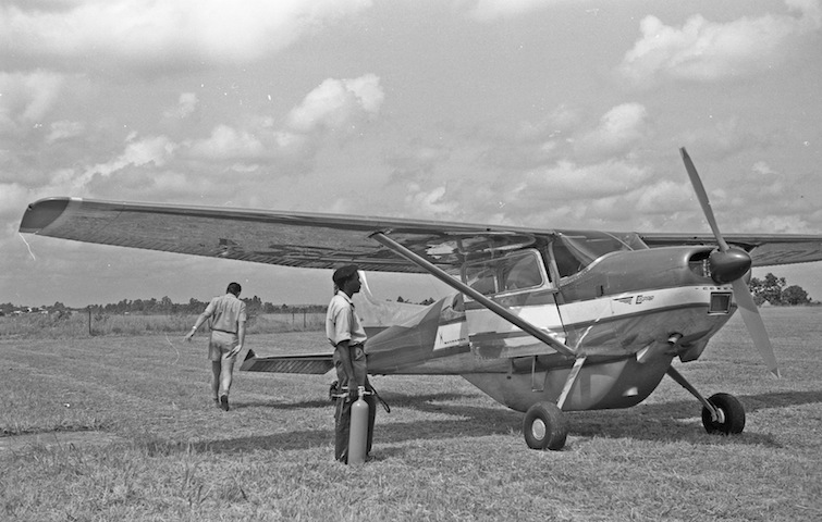
Rural landscapes of Uganda were photographed
from low-flying aircraft in 1963. The aircraft were rented
locally from the CASPAIR firm in Entebbe. Mostly small Cessna
150s were used ; occasionally a larger Cessna 185 as seen
here. For really remote or off limits places I was a guest
on flights with the police plane or one from the Tsetse control
people. Extensive additional information was gathered from
ground study in areas where over flight was not possible
or limited or to gather additional information. Among such
areas are Karamoja, West Nile and Kigezi.
The emphasis of this archive is on rural landscapes which
at the time were occupied by dispersed settlements. Tilled
fields, granaries, livestock , corrals and houses are viewed
in detail. Less commonly seen villages , towns , markets
and churches are also shown.
This coverage of rural Uganda is comprehensive but not complete.
Areas missed as inaccessible or for lack of permission to
overfly, include the foot hills of the Ruwenzori mountains
in the west; the central part of Acholi in the north (could
not manage to get back to that area): and the area from Mount
Elgon north to south Karamoja in the east.
Catalog entries are arranged as in North, East, Central
and West Uganda. Within these larger areas are the long standing
sociopolitical entities. Acholi, Bunyoro, Kigezi, etc., These
have persisted and have become with some modification the
major regions of the country (post 2007). Our concern is
to show the landscape as it appeared around 1963. We use
place names of that time.
NORTH
West Nile, East Madi( more commonly grouped with West Nile), Acholi, Lango,
Karamoja
EAST
Busoga, Bukedi, (Bagishu and Sebei not treated), Teso
CENTRAL
Buganda, Sese islands, Mubende
WEST . . . . . . .
. . . . . . . . . . . . . . . . . . . . . . . . . . . .
. . . . . . . . . . . . . . . . . . . . . . . . . . . .
. . . . . . . . . . . . . . . . Kigezi,
Ankole , Toro, Bunyoro
Short overview statements are included for
some socio political groupings; West Nile and so forth,
where this appeared useful in the context of the landscapes
at the time of observation.
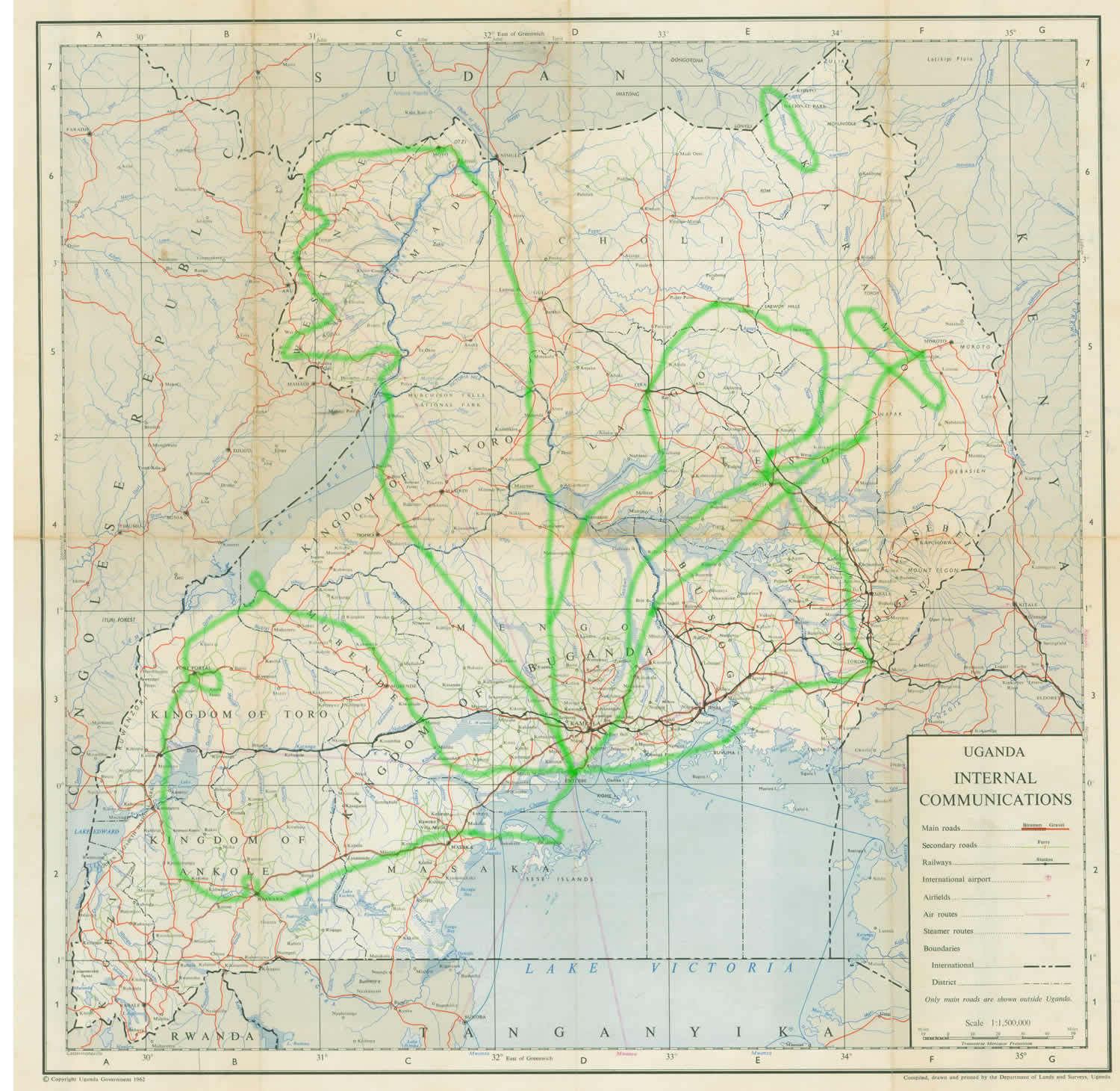
Location of features shown; latitude and
longitude are given when location is known to within a few
miles. Where it is less certain- within ten miles to fifteen
miles, the position is given with reference to a landmark:
a village or a mountain. The map used is the Internal Communications
sheet from page 61 the 1962 edition of the Atlas of Uganda,
Dept. of Lands and Surveys. Our flight tracks have been plotted
on this sheet.
. . . 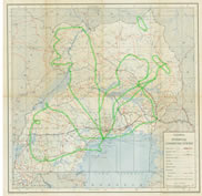 . . . . . . . . . . . . . . . . . . . .. . . . . . . . . . . . . . . . . . . . . . . . . . . . . . . . . . . . . . . . . . . View enlarged flight tracks map . . . . . . . . . . . . . . . . . . . .. . . . . . . . . . . . . . . . . . . . . . . . . . . . . . . . . . . . . . . . . . . View enlarged flight tracks map
Users
in need of additional detail will find it in the East Africa
1:250,000 scale Series Y503 Edition 1 USD 1962 and later
editions. These sheets were carried in the aircraft and used
for flight course plotting. Even with this guide We became
lost when weather deteriorated and clouds obscured the hill
tops (landmarks) as in our flight through Ankole. The low
clouds show in the images.
Excepting Kigezi with no overflight and
Karamoja where flight was limited : entries are shown in
sequence as they were photographed along a flight line. Users
can get a reading of changing landscape by using sequences
of entries along the flight tracks.
In 1963 rural Uganda was occupied by diverse culture groups.
Their distribution at the time is shown on the map by Goldthorpe
J.E. and F.B.Wilson. 1960. Tribal maps of East Africa and
Zanzibar. Kampala, Uganda: East African Institute of Social
Research. This was useful in sorting out the often complicated
group distributions in West Nile and in Karamoja.
. . . . 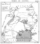 .. . . . . . . . . . . . . . . . . . . . . . .. . . .. . . . . . . . . . . . . . . . . . . . . . . . . . . . . . . . . . . . . . View enlarged cultural groups map .. . . . . . . . . . . . . . . . . . . . . . .. . . .. . . . . . . . . . . . . . . . . . . . . . . . . . . . . . . . . . . . . . View enlarged cultural groups map
|