

|
North East Uganda-Karamoja
This is the most extensive of the semiarid areas of Uganda. It has high evapo-transpiration with low and erratic moisture input. In the long dry seasons this is hot, dust laden country. An indicator of the existing water balance is the intermittent rivers which carry surface water only for a few hours to a few days after rains. They carry sub surface water for a large part of the year. This is the main dry season water source for people and for livestock. In 1963 there were only a few permanent late dry season water holes and a limited number of deep wells provided by the administration. Cattle watering during the late dry season was often difficult.
The settled areas were 3500 to 6000 feet in elevation, at latitudes of 1°30' to about 3° 45' north. This is tropical highland.
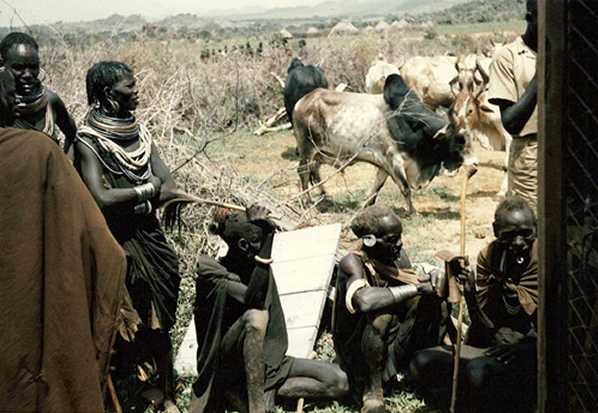
Note on lack of cattle visibility: although these were cattle keeping societies with two to four cattle per person, cattle were not visible in or around settlements during the day. They were being grazed and watered, near home settlements during the wet season but in the dry season 10 to 20 miles away at the few remaining water holes.
The distribution of tribal groups within north east Uganda is shown on the map on the home page. In the far north were the Dodos. To the west of Dodos, the Napore/Nyangeya were located along the Nyangeya mountains. South of the Dodos were the Jie around Kotido. Further south were the Karamajong with their subgroups: Bokora in the west, Mathiniko in the east and to the north of Moroto. The Labwor/Nyakwai were settled around the Labwor mountains in western central Karamoja. Not studied were the Teuso, a small group in the mount Zulia area, the Tepeth, a tiny population in the high mountains of the south and two Karamajong sub groups the Pian and Upe in the far south.